
Water Security Agency Issues Updated Runoff Forecast
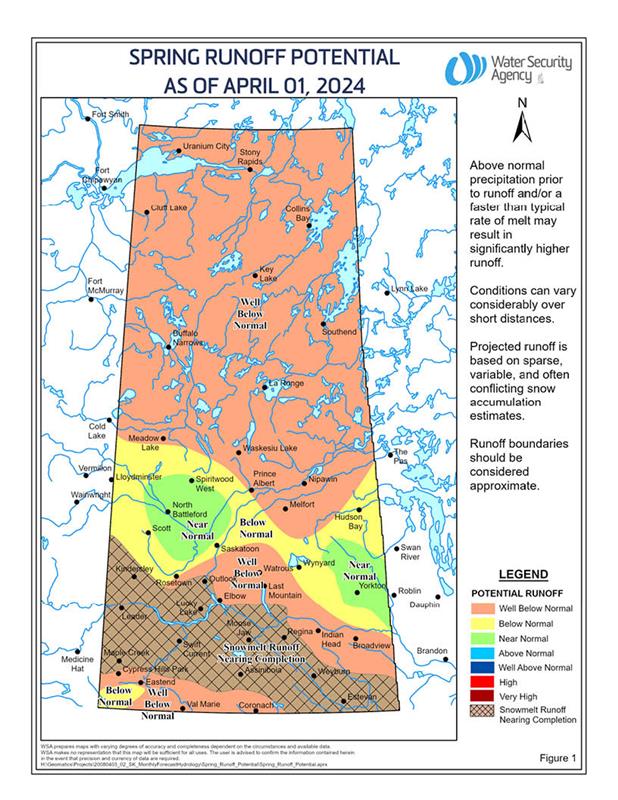
The Water Security Agency (WSA) issued an update to the Spring Runoff Forecast for 2024
Above freezing temperatures throughout the middle of March resulted in snowmelt runoff either beginning, or in some instances being complete, over much of southern Saskatchewan.
While many areas of the province’s moisture levels remain below normal or well-below normal in many areas of the province, late season snowfalls at the end of March have improved conditions.
Out of the 45 water supply reservoirs across the province, 33 are currently at or are expected to be at or near full supply when the runoff is complete. Six reservoirs are expected to be in the 70 to 90 percent full range. Only six are expected to remain low (Harris, Junction, McDougald, Downie Highfield and Roughbark reservoirs).
In mid-March, a snowstorm brought significant precipitation to a good portion of southern Alberta and to southwestern Saskatchewan. Much of this area across both provinces was snow free prior to this storm. This snowfall event improved the expected additional runoff volumes to some degree across Southern Alberta and southwestern Saskatchewan. How quickly the snow melts will impact how much additional runoff will be experienced in these basins. With the area being so dry prior to the snowfall event, if a slow melt occurs, a lot of the water will infiltrate into the soil.
Another snowstorm in late March brought 5 to 15 centimetres of snow across most of eastern Saskatchewan, with the heavier snow falling in the northeastern portions of the grain belt.
The river is still ice-covered in North Saskatchewan and the Saskatchewan River System. Flows are slightly above the median for this time of year. With most snowpack melted in the prairie and foothills of the basin, flows are not expected to pick up until the mountain runoff occurs.
A decent snowpack still exists in the Assiniboine Basin. In this area, ice layers were present during the snow surveys done at the end of February, and with the additional snow received over the past month, a near normal runoff is still expected.
The current snowpack accumulation in the Rockies currently varies significantly from well-below to near normal. The amount of runoff that we see from the mountains this year will depend on the timing of the melt event as well as May and June rains. These rains can quickly change the conditions in the basin. The high flow events that we often see during this these months are a result of the rainfall events. Based on the current snowpack in the mountains and the low water supply levels in Alberta, there is a higher probability that the inflows into Lake Diefenbaker this spring and summer will be below normal.
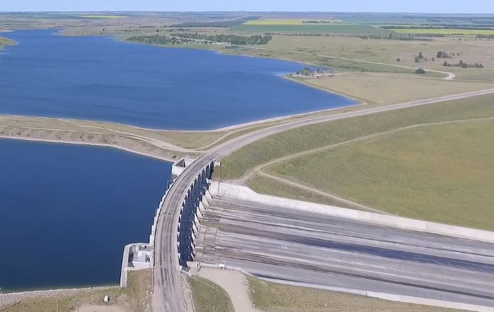
With the conservative winter plan implemented, the water level at Lake Diefenbaker was at 552.39 metres (m) on April 1, which is above normal for this time of year. Normal April 1 elevations are around 551.56 m.
Read the report here.
Google Play and the Google Play logo are trademarks of Google LLC.