
First Blast of Winter to Impact West Central Sask.
Fall weather will end abruptly later today and into tomorrow in west central Saskatchewan as a wintery system pushes into the province later Monday into Tuesday. Expected with the system is around 15cm of snow with up to 50 km/h wind gusts. The low will also bring with colder temps leading into the week of -5 to -10
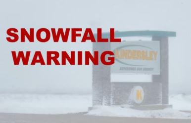
Snowfall warnings have been issued for Kindersley areas, Leader areas, Outlook Areas, Swift Current areas, and Craik (Moose Jaw Area) with special weather statements encompassing all of Southern Saskatchewan.
Snow rates will be heavy especially in the overnight hours on Monday with 2-3 cm falling an hour. With the warmer ground temps at this time of the year expect heavy slush to build on roadways and wind gusts to reduce visibility at times especially after nightfall.
Tuesday morning commute will be impacted by the system and snowfall will taper off around lunch time Tuesday. Give yourself time to travel and check highway hotline for road conditions.
By Jenny Hagan
Google Play and the Google Play logo are trademarks of Google LLC.